(Scroll down for Rick Allmendinger’s program Navigating by App in the Wild, an online program to help you use hiking apps safely.)
Chocorua Map App

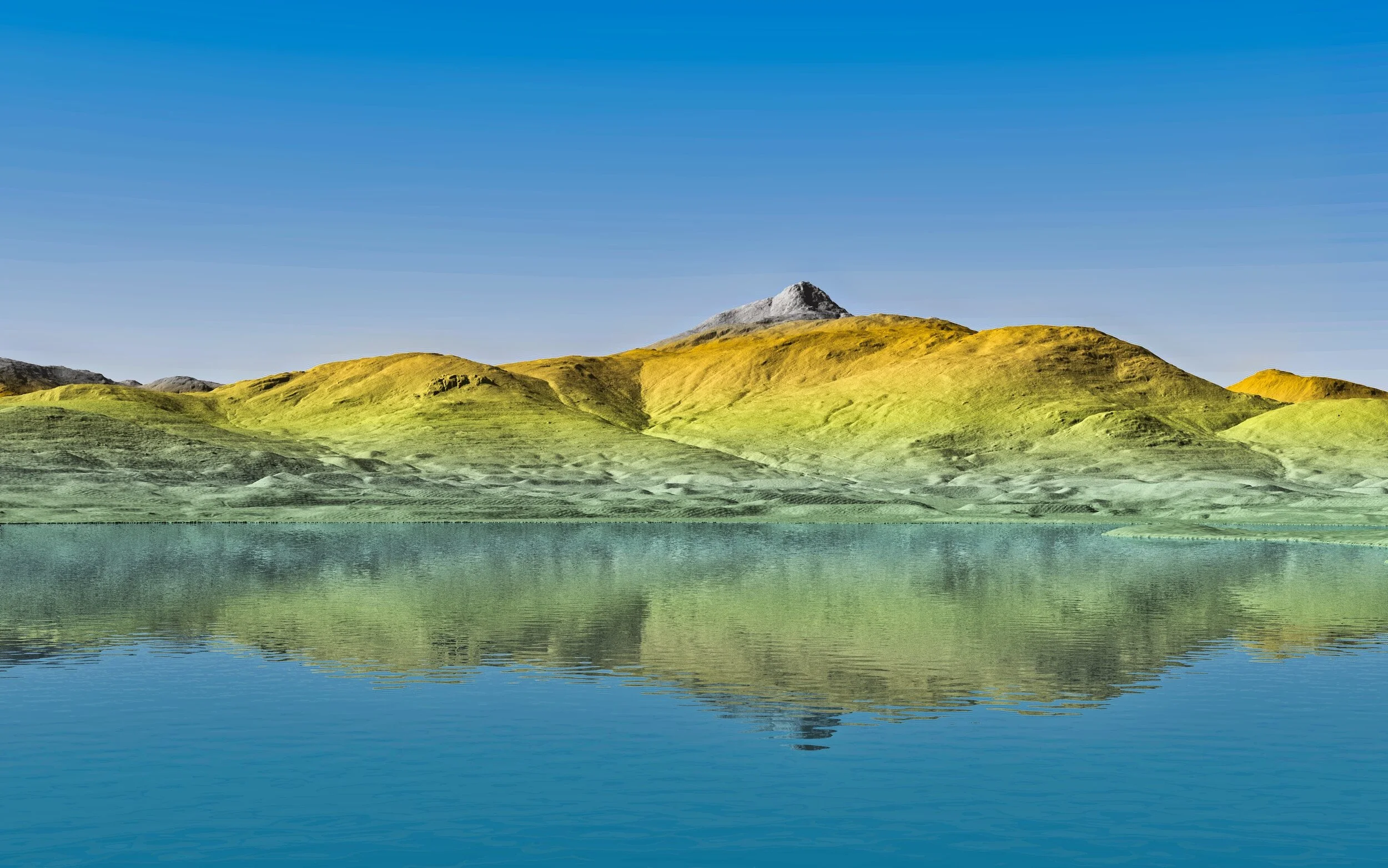
Each red dot represents a point of interest. Inside the app, you can click on each one to learn more. LiDAR image courtesy of Rick Allmendinger
What if you could have a personal guide to the Chocorua Basin and Mountain that would show you where the trails and publicly accessible lands are, what cool things to look for along the way, and explains how glaciation shaped the spectacular landscape?
Learn more about the basin with the Chocorua Map app!
iPhone and iPad owners can now experience the Chocorua Lake basin and trails with our new Chocorua Map app for iOS mobile devices. The Chocorua Map app uses an exquisitely detailed shaded relief base map created with LiDAR elevation points spaced every one meter (3.3 ft). All of the publicly-accessible trails in the region are shown as tappable traces that not only reveal the trail name and length, but also shows the hiker how far they have come and how much further they have to go. The app also incorporates a full digital elevation model so the user can plot trail profiles and measure how steep different sections of each trail are, as well as determining the position an elevation of every tapped point. To the earth scientist, the topography reveals the glacial history of the region in astonishing detail and the app, written by a professional geologist, communicates that history to the users as tappable points of interest (POIs) which contain a written description as well as a photo or diagram of the feature. For the truly geeky, the user can even toggle on a bedrock geology overlay. POIs are also used to illustrate points of historical interest with some quoting from Frank Bolles' iconic books on the regional natural history. Finally, the user can add their own points of interest and photos as a kind of digital diary of their explorations in the region; user POIs also provide a means to send a user’s position to another user via text or email.
The Chocorua Basin has notoriously poor cell phone coverage—a small price to pay for the preservation of a primeval landscape uninterrupted by cell phone towers—so the Chocorua Map app is completely self-contained with all of the information, topography, etc. that it needs to operate without any data connection necessary. Data are never downloaded from the internet and, unless the user explicitly chooses to send a text or email with their location to a specific recipient, all of their personal information remains completely private on their phone. The app is free to download for iOS devices and is not supported by any advertising; unfortunately, there is no Android version available at this time. If you are planning a trip to Chocorua or the lake basin, download the app and give it a try. If you find the app useful, please take the money that you would have spent on such an app and donate it to the CLC via the handy link in the app’s Info screen!
The Chocorua Map app was written by longtime summer resident Rick Allmendinger. As a professor of geology, he realized early on the power of mobile devices to help us explore the world around us. The app is based on his LiDAR shaded relief map of the Chocorua area that, for the first time, enables earth scientists to piece together how the landforms of the basin came to be. Rick has hiked virtually every trail depicted in the app and taken new photographs and made new drawings to illustrate the points of interest.
Chocorua Map app user manual
Rick has also created a detailed Chocorua Map app user manual with details about how to use the map, and an explanation of how and why the app will never track your data. Thank you, Rick, for creating this wonderful community resource!
System Requirements:
A 64-bit iOS device (iPhone 6S or newer, iPad Air or newer, iPad Mini 2 or newer)
iOS v. 10–13 (you must have upgraded your system within the last 4 years)
At least 200 MB of free storage space
high resolution digital elevation model (DEM) files for the Chocorua Map app
High resolution digital elevation model (DEM) files are available as an add-on to the Chocorua Map app. Be aware that the files take up more than 500MB of space. They are available here as a .zip file. The Chocorua Map app user manual, downloadable above, contains information on how to install the high resolution DEM onto your device. Editorial note: the high res DEM files are not yet available below due to technical difficulties. We’re working on it!
Watch all four parts of Rick Allmendinger’s online program Navigating by App in the Wild above, or click through to YouTube to view the four-part playlist.
Banner: LiDAR image of Chocorua Lake and Mount Chocorua. Image courtesy of Rick Allmendinger