A gorgeous, packed issue!
News
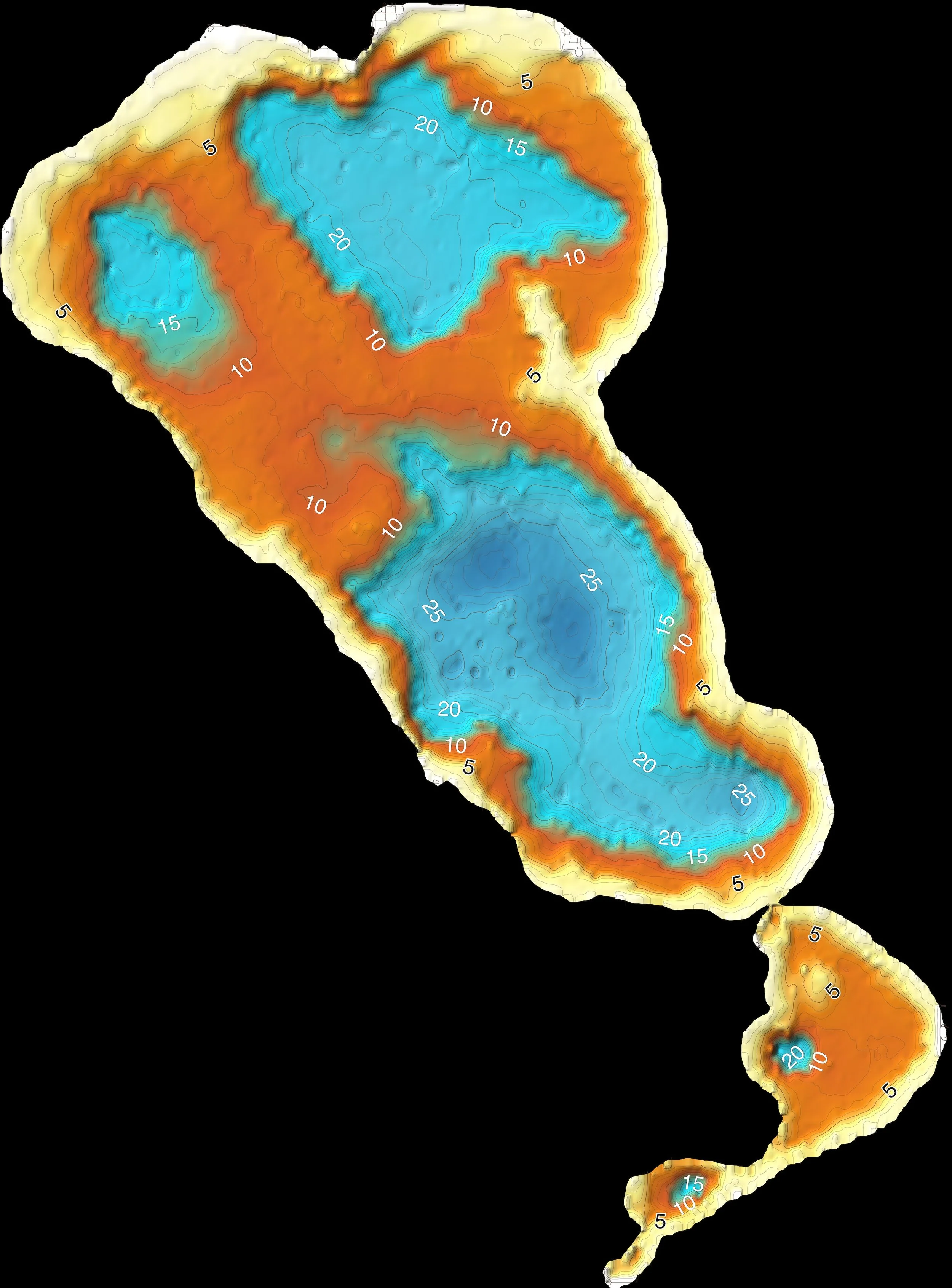
Though we admire the topography surrounding Chocorua Lake, we seldom think about the fact that the lake bottom has its own topography, referred to as “bathymetry.” The shape of the land surface, above or below water, tells a story of the natural forces and processes that shaped the earth—how mountains and lakes came to be.
Writing, art, and poetry about the Chocorua Lake Basin, musings on the importance of naming things and knowing the names of things, photos at the lake from a 1920 family album, info about covenants, GIS, Leave No Trace, and loons, a calendar of summer events, updates on CLC activities, our Annual Report, and more.
We are honored to be featured in the spring issue of MVW Vibe—check out the gorgeous cover photograph by Dan Houde of Wiseguy Creative, Editor of MWV Vibe.
Thanks to Cornell geology professor Rick Allmendinger, iPhone and iPad owners can now experience the Chocorua Lake basin and trails with our new Chocorua Map app for iOS mobile devices.